Camping Tools, Shelter Gear, Cooking & Clothing - GPS, Tents, Sleeping Bags, Boots & More!
Camping Tools, Shelter Gear, Cooking & Clothing - GPS, Tents, Sleeping Bags, Boots & More! Camping Tools, Shelter Gear, Cooking & Clothing - GPS, Tents, Sleeping Bags, Boots & More!
Cart(0)
Home Tools & Navigation Map
Product Details

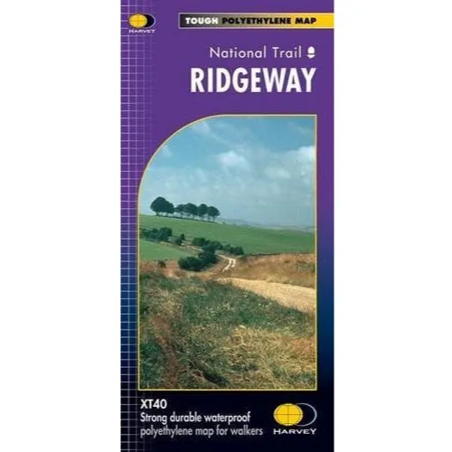
Ridgeway edition covering the entire national trail. Covers parts of the A100 and CW50 Courses.

Harvey Maps provide one map for each National Trail in it's entirety - printed on waterproof paper. All you need come recce or race day.

Information on finding accommodation, camping, food. Also Ranger Service contact numbers and enlargements of towns/villages showing facilities available and tips on weather and clothing.

Detailed mapping, full legend. National Grid - can be used with GPS. 1:40,000 scale. Waterproof but much lighter than a laminated map. Supplied in clear plastic pocket.

Harvey Maps Ridgeway

  • DefaultTitle

$ 15.00

Please select combo product attributes
The combo subtotal is $,SAVE$
Unavailable

You May Also Like

Land Breeze Pro 4

$ 61.04

$ 79.35

Land Breeze Pro 4
NS Induction Base Kadai

$ 53.98

$ 70.17

NS Induction Base Kadai
Cart
Camping Tools, Shelter Gear, Cooking & Clothing - GPS, Tents, Sleeping Bags, Boots & More!
Your cart is currently empty.